On the 7th January, in the afternoon, we have discovered the 'lost valley' of Yuboku!
It all started with a one-day trip to the Eastern side of the Gunnestadbreen glacier with Gigi, René Robert and 2 German geologists. There were quite a lot of crevasses and sastrugi (ridges formed by the wind), so that the skidoos were quite shaken, but no big problems on the way. We started to work in Svindlandfjellet near the Takano-tume Peak. This place is in front of the Antarctic plateau, so conditions are more harsh (colder and windier) than in the Utsteinen area. I could find only one lichen (Xanthoria borealis or elegans, I have asked the help of Damien Ertz) on the Northern side of one big old boulder. There was no visible life on the Southern slope.
 |
| Microscopic lichen |
 |
| Microscopic observation of the lichen |
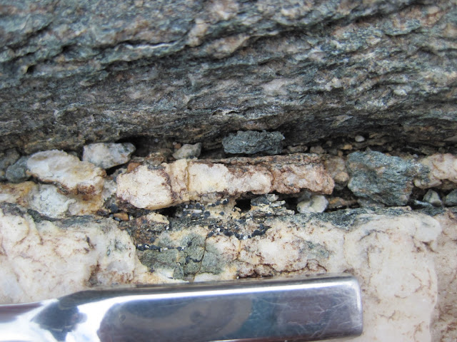
René Robert was a very precious help, and I am very amazed by his ability to find interesting things. Maybe that this is thanks to his 'photographic' eye? He spotted one extremely interesting boulder with microscopic lichens and a cryptoendolithic community. The German geologists were very impressed by the rocks also.
The most important discovery was still to come! After the Takano-tume Peak, we entered into the Yuboku Valley. I call it 'The lost valley' because it is so remote and mysterious. It is located in Svindlandfjellet, but on the Northern side. The valley is well protected from the winds, is exposed to the North (thus to the sun in this hemisphere) and has several glaciers. It could be the perfect microenvironment for life. We stayed there with Gigi. René Robert and the geologists went further to the East.
 |
| Unnamed lake in Yuboku valley (Northern side of Svindlandfjellet) |
And there it was, the first real lake in the Utsteinen area! We were so lucky to discover it! The last two years, Jeroen, Elie and Steve have looked for lakes, but could not find any in the places which they surveyed.
The lake was located in the center of the valley in the moraine. Maybe that there are additional lakes in the valley? We had no time to go further as the evening was coming. The GPS coordinates were 72 04'53.1", 23 47'37.1", 1333 m.
The lake is ~50 m in diameter and ice-covered. On the southern side, there is a 1 m wide ice-free zone along the shore. It is called a 'moat'. I could see bubbles under the ice, which indicates that there is some production of gas, most likely due to photosynthetic organisms. There were thin cyanobacterial mats between the stones on the shore and littoral zone.
 |
| Cyanobacterial mat in the lake |
The top layer of mat is green, and by microscopy, I could observe that it was dominated by cyanobacteria, particularly Nostoc commune. Thin filaments of Leptolyngbya were also present.
 |
| Nostoc and Leptolyngbya spp. in the green layer |
The lower layer is red, dominated by Leptolyngbya, Nostoc sp. Filamentous cyanobacteria looking like "Leptolyngbya with thick sheath" or "Microcoleus with single filaments in one trichome" are also present.
 |
| Filamentous cyanobacteria in the red layer |
The water temperature was +1 C, the pH was 9.3, and the oxygen concentration was 10.5 mg/L.
Probably we'll go back to the lost valley of Yuboku. We'll try to drill the ice in the center and collect some sediments with a tube, if it will be possible. I know that Elie Verleyen will be very interested by this finding (see 'DELAQUA' and 'Elie Verleyen' on this blog).
Cheers after a long and fruitful day, Zorigto

Aucun commentaire:
Enregistrer un commentaire